
Points' attributes related issues
Hi there!
For Pro version.
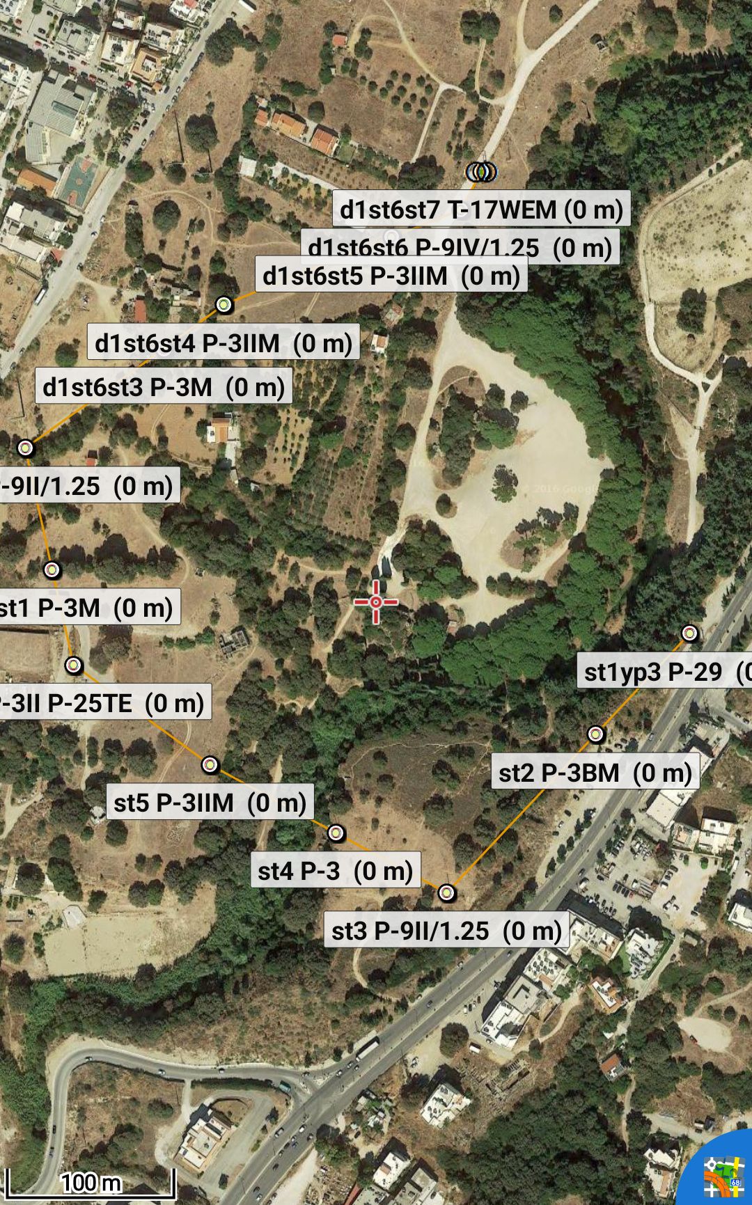
1) When I import a kmz file the altitude is shown on the map for each point which I cannot get rid of. Even if I choose not to be shown during the import still appears inside parentheses with 0 value (photo #1).
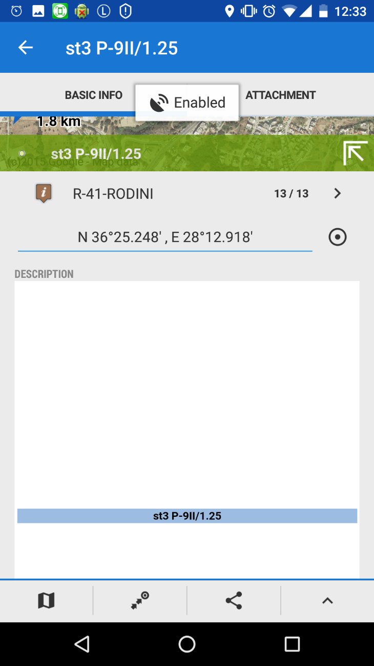
2) When I tap on a point to check the related attributes a huge void white table as a background to the point's HTML attribute table is displayed which was not present in the previous version. This is quite annoying since I have to scroll downwards quite a lot to finally see the attributes (photos #2 and #3).
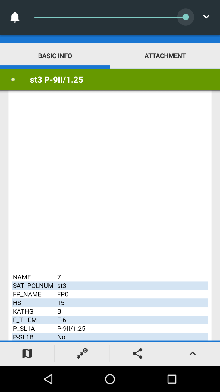
I have also a question: Is there any way to make an SQL-like query search through the attribute tables (search-by-attributes query)? For example, can I set a query like: Return me all the points where "KATHG=B AND F_THEM=F-6" (see 3rd photo).
Thank you in advance!
PS: Your application really rocks! :-D
 The same problem
Good day,
thanks for contacting us, I was little worried we will discuss over Google Play comments :).
To check more precisely where is a problem, may you please share a KMZ file to test?
To your question: all "extended data" from KML files are unfortunately converted to simple text description and added to point. Because Locus Map is focused on hike & bike, these advanced methods, that are more common in GIS software, are not needed so they are not included. Thanks for understanding.
Good morning Ioannis,
thanks for a file.
1) elevation values
placemark coordinates are defined as
where third '0,00' value define elevation. That's why Locus Map display it. If you wants points without elevation, it should looks like only as
2. issue with long description in app ... thanks, will be fixed in next version
And Locus GIS, something like this https://play.google.com/store/apps/details?id=menion.android.locus.gis . Anyway Locus GIS also does no support search in attributes and even if so, your data are currently only in description. Thanks for useful bugreport!
Replies have been locked on this page!