Problem with "Automatic zoom" together with "Magnify all maps" in 3.38
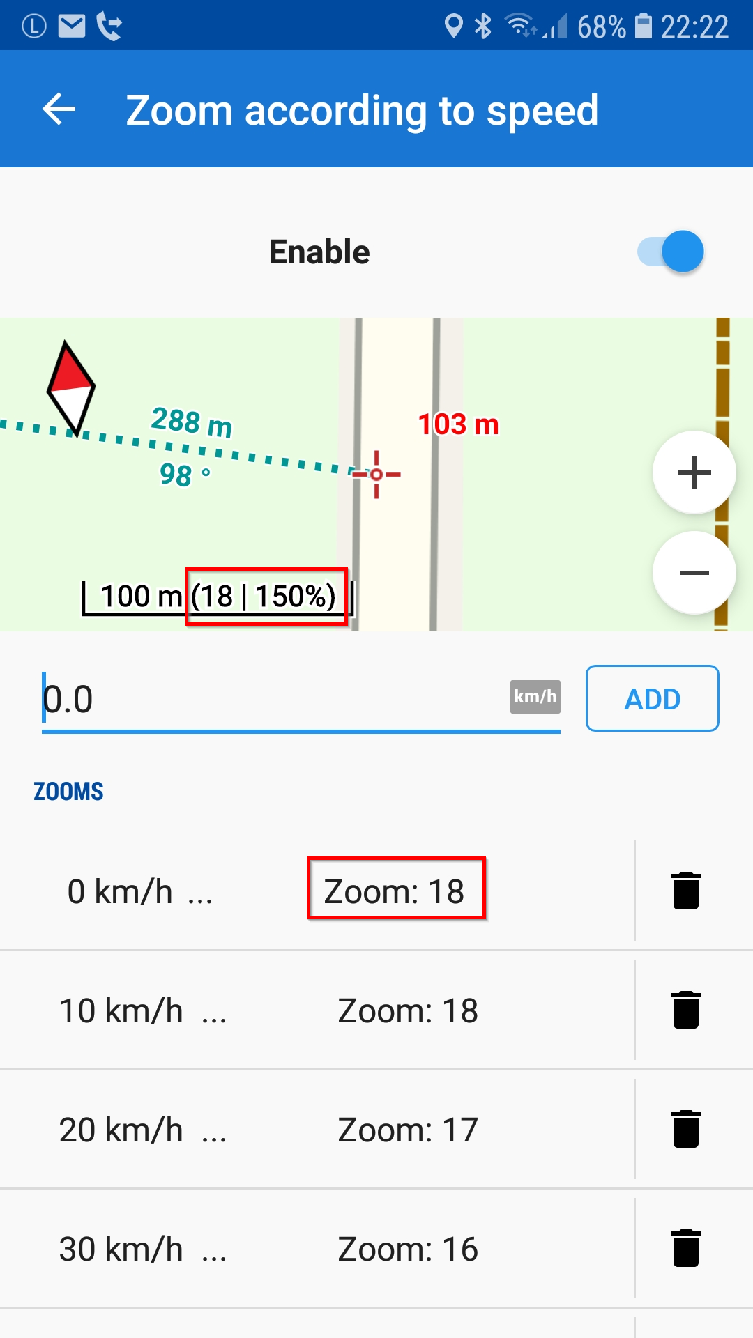
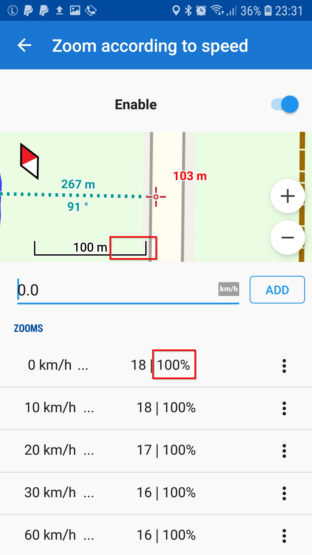
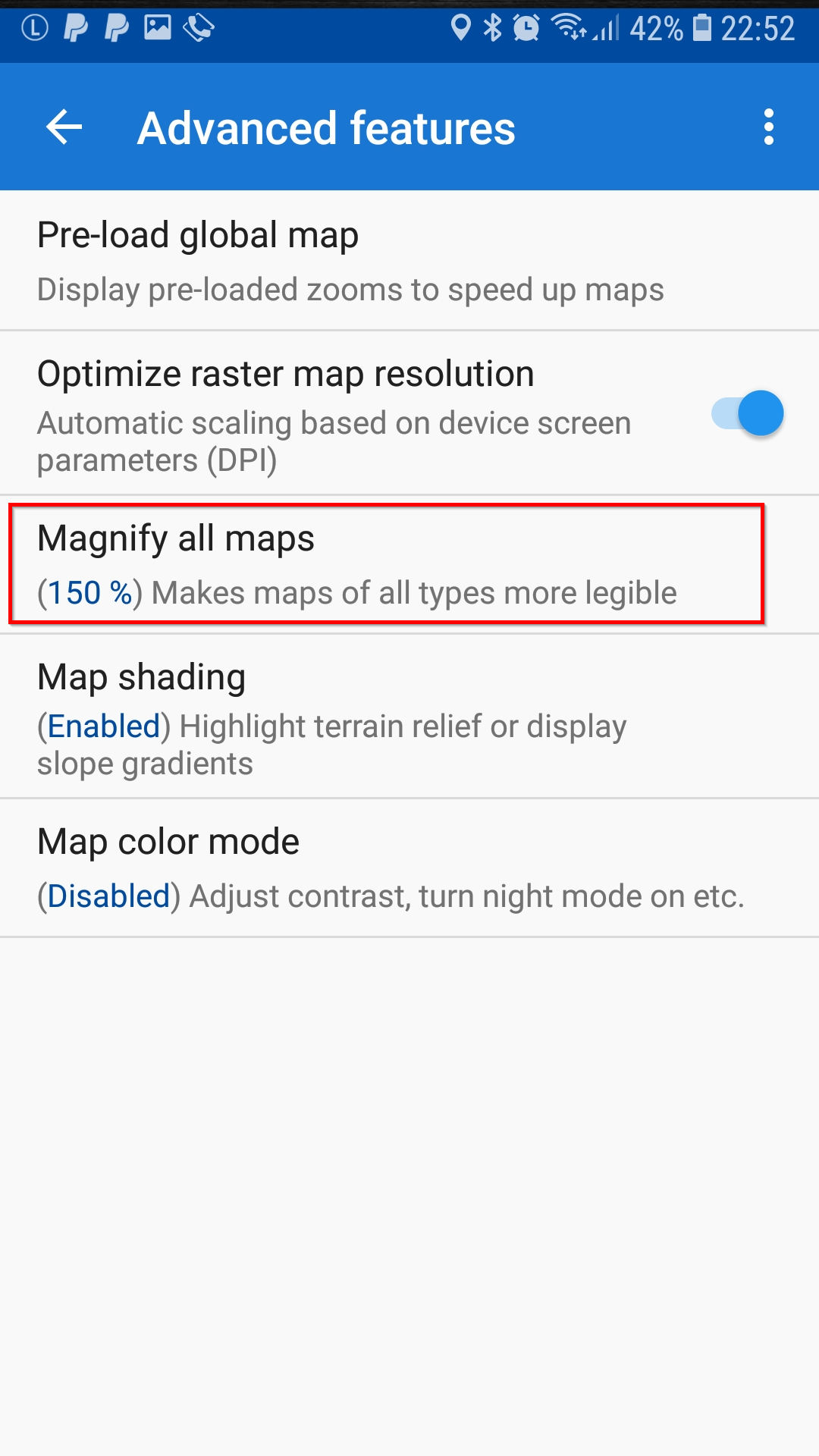
I think there is a problem in 3.38: "Automatic zoom/Zoom according to speed" doesn't work together with "Magnify all maps" correctly. I set "Magnify all maps" to 150% and I set Automatic zoom to 18 at 0 km/h and 10 km/h. As a result, Locus set the zoom value to 17/200% in the map(?)
In 3.37 Locus sets the zoom value to 18/150% - that's what I expect in 3.38 too.
With "Magnify all maps" deactivated Automatic zoom seems to work correct in 3.38
In addition: The dialog to define "Automatic zoom/Zoom according to speed" was better in 3.37. In 3.37 I could see the actual zoom/% value in the display. And 3.38 shows % values in the list of values - I think the % value is unnecessary because it's set with "Magnify all maps" and should not occur in the list of values in "Zoom according...".
3.37.2:

3.38.3 Pro + Beta:

3.38:


 The same problem
Hi Wolfgang,
have you tested this on the newest Locus 3.38.4.?
Michal
Hi Wolfgang,
have you tested this on the newest Locus 3.38.4.?
Michal
Good day Wolfgang,
seems I have to get rid of these numbers completely. They are not anymore precisely describing the final zoom value set during movement.
I'll look and it and try to improve this to next Locus Map version, thanks for bug report.
Menion
Good day Wolfgang,
seems I have to get rid of these numbers completely. They are not anymore precisely describing the final zoom value set during movement.
I'll look and it and try to improve this to next Locus Map version, thanks for bug report.
Menion
Hello Menion,
I think you should try to stay with these zoom-numbers somehow - just to be able to communicate and to refer to something like zoom levels.
In my opinion it makes some sense to be able to refer to zoom levels e.g. in the definition of "Zoom according to speed". In the definition I would suggest to use the zoom levels (e.g. between 18 and 14) but not the % values in addition in this definition - like in 3.37. This should be fine enough to define auto zoom.
In addition it should be possible to define "Magnify all maps".
Even if you calculate internally with long (64 bit) or even longer... - you should try to calculate something like zoom levels and % according to magnify... values for the communication with the user. I think it was ok in 3.37 to use + and - zoom to switch between the zoom levels with the fix magnify % values.
I see your point calculating values back from an actual dynamic zoom value (not level) displaying the map during movement e. g. in auto zoom or when zooming in the map with a gesture. I hope you find a way to calculate/to show values for zoom level + magnify % similar to 3.37
Wolfgang
Hello Wolfgang,
In next (Beta) version, setup of auto-zoom will be improved little bit. I have completely replaced zoom values (numbers) with small scale bars. I am not perfectly satisfied with it, so some feedback will be welcome.
Hello Wolfgang,
In next (Beta) version, setup of auto-zoom will be improved little bit. I have completely replaced zoom values (numbers) with small scale bars. I am not perfectly satisfied with it, so some feedback will be welcome.
Hello Menion --
Sorry for the delayed response; I did not notice this change until I had occasion to change some Automatic Zoom settings.
I had the same problem with Automatic Zooming and Magnify All Maps, so I am happy to see an approach which accounts for both. However, I have encountered some problems in the "Automatic Zooming" dialog:
1. Adding a new ZOOMS entry seems unreliable. Sometimes it works as expected. Sometimes after SAVE, an existing entry has disappeared from the list, or has had its scale value replaced. Tapping (+) and then BACK/CANCEL makes the missing entry visible again (with its value replaced).
2. I find the scale bars for Automatic Zooming confusing. The list of scales shown by the map display (-)/(+) buttons, by the Automatic Zooming (-)/(+) buttons, and by the ZOOMS list are all different. This makes it hard to calculate what settings to select, and hard to note down the settings in case I need to restore them. For example, if I want to use scale 16 as a zoom level, the map display shows a 0.5 mi scale bar. The closest Automatic Zoom selection (without pinching) is 0.6 mi. Adding that as a ZOOMS entry shows a 0.4 mi scale bar. Similarly, map scale 18 shows scale bars of 700 ft, 800 ft, and 500 ft, respectively.
Ideas:
a) One improvement would be to have all three places use the same set of zoom increments and scale bar lengths. Then it would be easier to calculate what settings to select, and to note down the settings in case I need to restore them later.
b) I view scale bars as a holdover from paper maps. They require ruler measurements and math in order to figure out distance on a map. That seems anachronistic on a computer which can do graphics and calculations.
What I would REALLY like to select from is the viewable map size (width x height). For example, if I want the map to show about a half mile ahead and half mile behind when walking at 3 mph, then I should be able select something like "Map Size 0.5 mi x 1 mi" to add to the ZOOMS list. The Automatic Zooming preview display could show the view size dynamically, perhaps replacing the scale bar, or perhaps as a rectangle with two sides labeled.
Or alternatively, something like:
The size of the viewable area should reflect the current Magnify All Maps setting and the hardware screen size. I have been doing such calculations in a spreadsheet, based on ruler measurements of screen and scale bar. It would be much nicer if Locus could do that for me.
Thanks for keeping up an outstanding app,
-- George Snyder
Replies have been locked on this page!