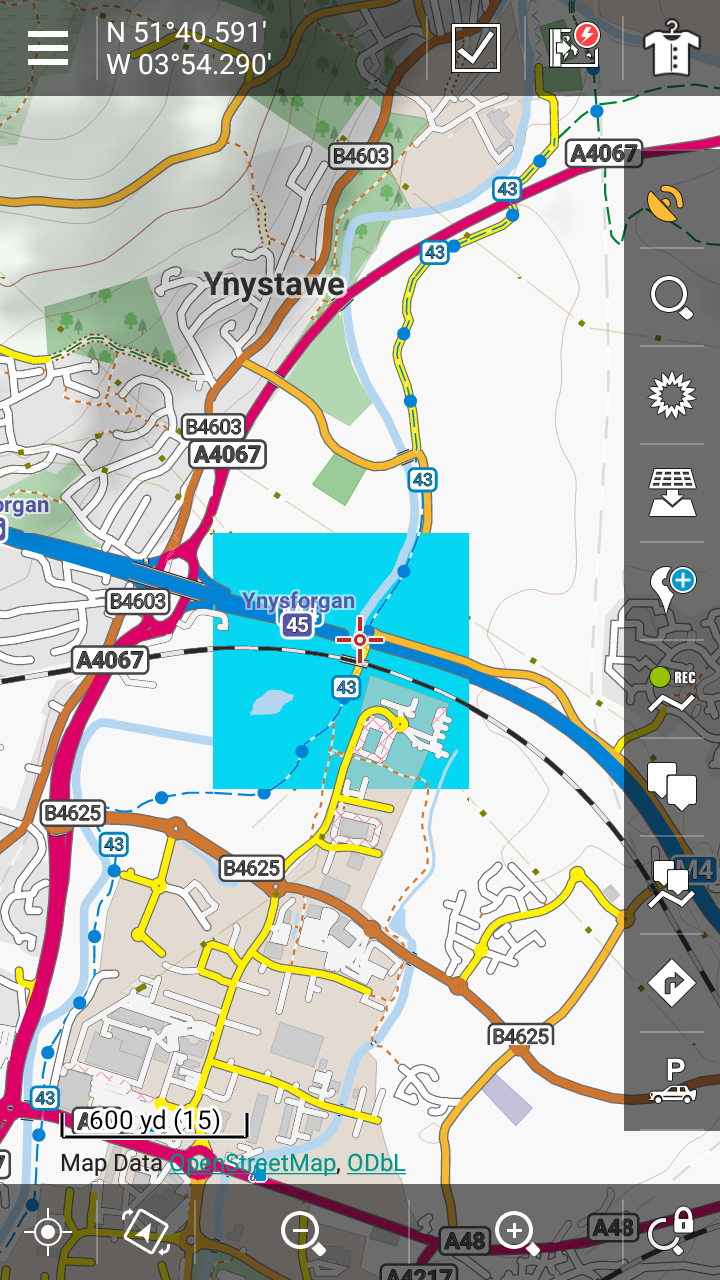
Sea squares in OAM Great Britain map
Known
Using the latest OpenAndroMaps Great Britain map on Locus with any theme I find a
square of sea inland at N 51° 40.591′ W 03° 54.290′ at zooms 13-15. The
screenshot shows the square in bright colour, as I tweaked the theme I
was using to identify the source of the problem.
The response I got from Emux on on the OpenAndroMaps forum was:
"Thats one of the rare occasions where tiles are rendered wrong in Locus
while using the latest Version of the mapsforge renderer. The map istself is OK – Displayed in Atlas"


 The same problem
Is there a reason why this request has not been processed?
Is there a reason why this request has not been processed?
confirmed - Petr?
confirmed - Petr?
Sorry guys - I've overlooked this topic. Anyway you answered this problem in the description. Locus really renders some tiles in wrong way. We know this issue but we do no want to spend time with it until the final decision about upgrade of mapsforge renderer.
Sorry guys - I've overlooked this topic. Anyway you answered this problem in the description. Locus really renders some tiles in wrong way. We know this issue but we do no want to spend time with it until the final decision about upgrade of mapsforge renderer.
Replies have been locked on this page!