
Weak hill shading contrast in Northern Germany and Artefacts
I don't find the hill-shade with the cards offered for the LoMap cards particularly helpful:
- It's much too weak for my taste. If you don't look closely, you don't really see any hill shadin. Even if it is not a low mountain range, there are some gradients in the depicted areas that the hill shade ignores.
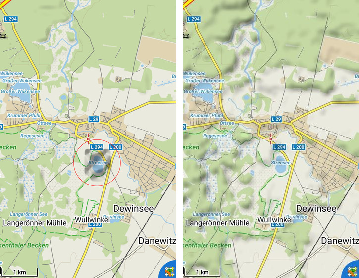
- In some cases, however, artifacts occur in which hill shading is completely exaggerated.
In the forum I discovered that you can also use SQL files for rendering. In my opinion, these deliver much better results. However, the price is a slower display.
Here are some example. Left rendering with HGT files, right rendering with osmand SQL files:
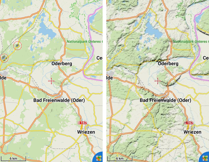
Even if gradients here in Brandenburg are not as steep as in the Alps, they are especially relevant for racing biking. If you plan your routes with Locus-Map, however, you will not see them at all, although there are sections with a gradient of >10 percent in the areas shown.
The artifacts are simply annoying.
To use the osmand sql files is for me a bad work-a-round. Is there a way how to iomprove the rendering with HGT files?
Regards, Benjamin B.
 The same question
Good day Benjamin,
thank You for a detailed description of your problem.
I see two issues here : artefacts and not too detailed shading.
Problem that is solvable: artefacts. It looks like you are using probably an older versions of elevation files used for rendering. Most easy how to solve this: completely delete all files in Locus/data/srtm and download data again over Locus Store (just open downloaded map in Locus Store and tap on map button next to "Coverage" label. With this method, you will download new data, that won't for sure have these artefacts. In worst case if they will be still there, delete also Locus/cache/maps directory. Sorry for a little complicated method, it's something we definitely should improve for such cases.
Second problem with detail of shading. As I see, area is really quite flat here and unfortunately with technique we use, it is hardly possible to improve this. So I have no solution on this problem for now, sorry.
Suggest for you planning, to use new Route planner where at bottom of screen is immediately visible elevation chart, that may really helps to avoid some bigger slopes.
Hope this helps.
Menion
With this high-resolution hillshade/relief map overlay you will see even small elevations changes in otherwise flat terrain.
With this high-resolution hillshade/relief map overlay you will see even small elevations changes in otherwise flat terrain.
Replies have been locked on this page!