
This object is in archive!
Croatia hggs map missing parts
Answered
I bought several hgss maps on Locus store.
Between 2 maps there is some "white space", where the map is missing.
On the original map on https://www.hgss.hr/kartografija/ these parts are on the map.
See screenshot
Is there something I can do to fix this.
 The same question
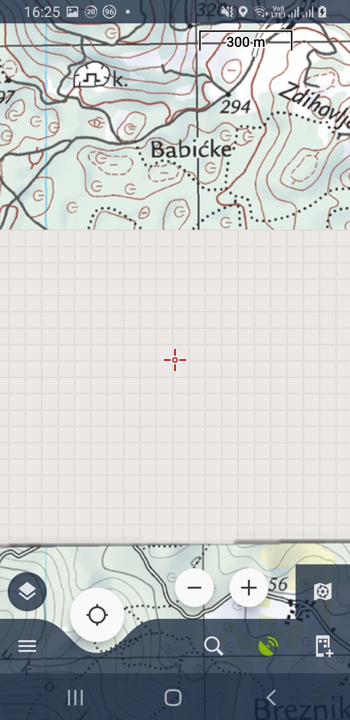
Dear Sebastian,
thank you for the message and I'm sorry for this problem. Which two maps (name) are around this "hole", please?. I'll check them.
Thanks, Petr
Dear Sebastian,
thank you for the message and I'm sorry for this problem. Which two maps (name) are around this "hole", please?. I'll check them.
Thanks, Petr
Thanks for your quick response.
It's the under part of Žumberačko gorje.
The other map is the one of Karlovac - Duga Resa.
Many greetings
Thanks for your quick response.
It's the under part of Žumberačko gorje.
The other map is the one of Karlovac - Duga Resa.
Many greetings
Hi,
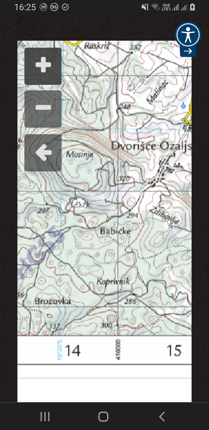
thank you for the map names. Unfortunately, it's not an error but there is really a "gap" between the map sheet. Please see the attached screenshot - depict the official coverage of HGSS maps. I'm sorry but the area of coverage is defined by HGSS we can't change it
Thanks, Petr
Hi,
thank you for the map names. Unfortunately, it's not an error but there is really a "gap" between the map sheet. Please see the attached screenshot - depict the official coverage of HGSS maps. I'm sorry but the area of coverage is defined by HGSS we can't change it
Thanks, Petr
Yes, you are right. Thank you for your time and effort to check it out!
Yes, you are right. Thank you for your time and effort to check it out!
The gap is annoying for me, as I have a house close to the upper side of the Karlovac map, so I often walk or bike in this part.
But I think I could be the only one, as only very few people live there.
The gap is annoying for me, as I have a house close to the upper side of the Karlovac map, so I often walk or bike in this part.
But I think I could be the only one, as only very few people live there.
Hello Petr
It seems to me this settings make no difference, but maybe I don't understand the part of "Return back to Menu > Map manager > and select the upper map to display it."
For me, all the hgss maps are one setting, I can not choose between them.
If I don't do it right, please tell me.
Thanks
Sebastian
Dear Sebastian,
I'm sorry, I just wanted to write to select the HGSS map in the map manager. The goal is to display only one map in the map window (with disabled autoloading). After that, it's possible to check the map coverage.
Thanks, Petr
Dear Sebastian,
I'm sorry, I just wanted to write to select the HGSS map in the map manager. The goal is to display only one map in the map window (with disabled autoloading). After that, it's possible to check the map coverage.
Thanks, Petr
No, it remains the same with the autoloading disabled. The gap becomes bigger as I zoom out, and smaller when I zoom in. From zoom level 400m I see the most downward tiles.
Doesn't matter much to me, but maybe it's interesting for you :-)
Greetings
Sebastian
No, it remains the same with the autoloading disabled. The gap becomes bigger as I zoom out, and smaller when I zoom in. From zoom level 400m I see the most downward tiles.
Doesn't matter much to me, but maybe it's interesting for you :-)
Greetings
Sebastian
Replies have been locked on this page!