
This object is in archive!
LoMaps: Quality of contour lines declined
Solved
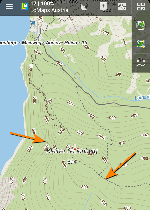
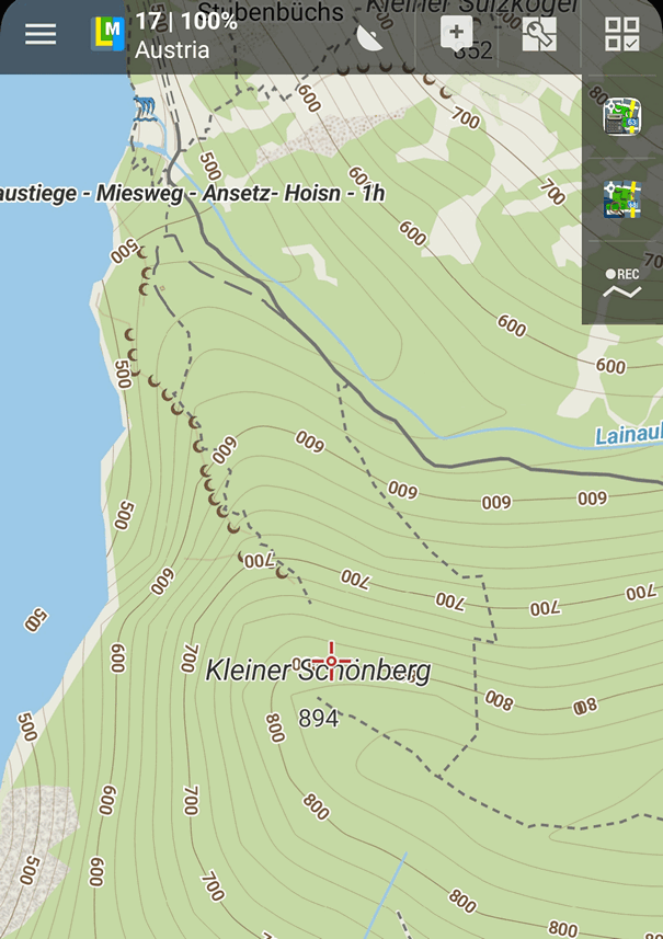
I compared an older version of LoMaps Austria (2019-11) with an actual version (2022-03) and noticed that the quality of contour lines declined.
Please have at look at both screenshots (coordinates N 47.853°, E 13.818°), especially on the areas on the older map marked by arrows. One is a steep slope of a mountain, the other one points towards a saddle which isn't existing in the newer map. Or look at the absurd lines on the lake's bank on the new map, which should be approximately parallel to the bank in reality.
Would be nice if you can improve the quality of contour lines again, maybe by using Sonny's LiDAR elevation models of Europe https://twitter.com/SonnyLidarDTMs ;-)
OLD MAP:
NEW MAP:
 The same problem
Thank you for the topic.
We use the excellent lidar data for the elevation data we distribute to our users, for shadings, etc. But it seems that contour lines for LoMaps weren't updated for several months... We'll improve it for the next version of LoMaps... a stupid mistake.
Thank you!
Petr
Thank you for the topic.
We use the excellent lidar data for the elevation data we distribute to our users, for shadings, etc. But it seems that contour lines for LoMaps weren't updated for several months... We'll improve it for the next version of LoMaps... a stupid mistake.
Thank you!
Petr
Replies have been locked on this page!