
Tilehunting square/tile grid
When I go out for ride with route prepared to collect new tiles for tilehunting game (https://www.statshunters.com/faq-10-what-are-explorer-tiles) I often find out that the little path in forest in my route no longer exist and similar situations. Than have to improvise.
To know better if this is in already collected area or I will miss some planned tiles I use tool by Liskin (https://liscopridge.nomi.cz/statshunters/) which imports me the overlay. Little inconvenience is that if I for example planing to ride "zig-zag" between to rows/columns of new tiles and I don't have much of reference where some tiles ends.
There is already coordination grid available in Map-screen content, can we get also tile grid please?
Liskins kml export have option to show also tile boundaries, but according his testing it makes Locus really slow.
When riding over my max square, it starts to be ~120-150 km round-trip ride for me and stupidly miss some square would be annoying.
How big are the tiles?
https://rideeverytile.com/how-big-is-a-tile
Thank you
 I like this idea
Hi,
I miss knowledge regards Statshunter anyway by "tile", Do you mean a grid of the map tiles? You may try to enable developer tile bounds. Check "Expert options" > Draw map tile bounds.
Hi,
I miss knowledge regards Statshunter anyway by "tile", Do you mean a grid of the map tiles? You may try to enable developer tile bounds. Check "Expert options" > Draw map tile bounds.
I have enabled expert settings and looked for "Draw map tile bounds" but didn't find it there.
Basic idea about the tiles is that you split the world into sections, which corresponds with map tile of zoom 14 OSM map. Then you record the activities and tick off tiles you visited. More is better and you have other metrics to increase the fun. Like what is max square you can inscribe to your continuous visited area ....
I believe it was first introduced by Veloviewer tool but I personally use Statshunters for the same.
Following links lists more info.
https://blog.veloviewer.com/veloviewer-explorer-score-and-max-square/
https://rideeverytile.com/how-big-is-a-tile
https://www.statshunters.com/faq-10-what-are-explorer-tiles
Drawing map tile boundaries could match only in one zoom so it could be good workaround but not accurate.
I see that Coordinates grid function says "Not yet implemented" when clicking the item itself not show/hide button on side. This hits that you planned already to have this feature available in multiple coordinates systems and these tile boundaries could be one of them.
Hi
# I have enabled expert settings and looked for "Draw map tile bounds" but didn't find it there.
scroll down to the 4th last entry (bounds>yellow area in screenshot)
# I see that Coordinates grid function says "Not yet implemented" when clicking the item itself not show/hide button on side.
click on "eye icon" and it will be displayed, coordinat format as selected in settings/language&units
(red area in screenshot)
I understand how the eye button works. When I change coordinate unit to UTM, it is somehow close but still not matching and grid changes in each zoom.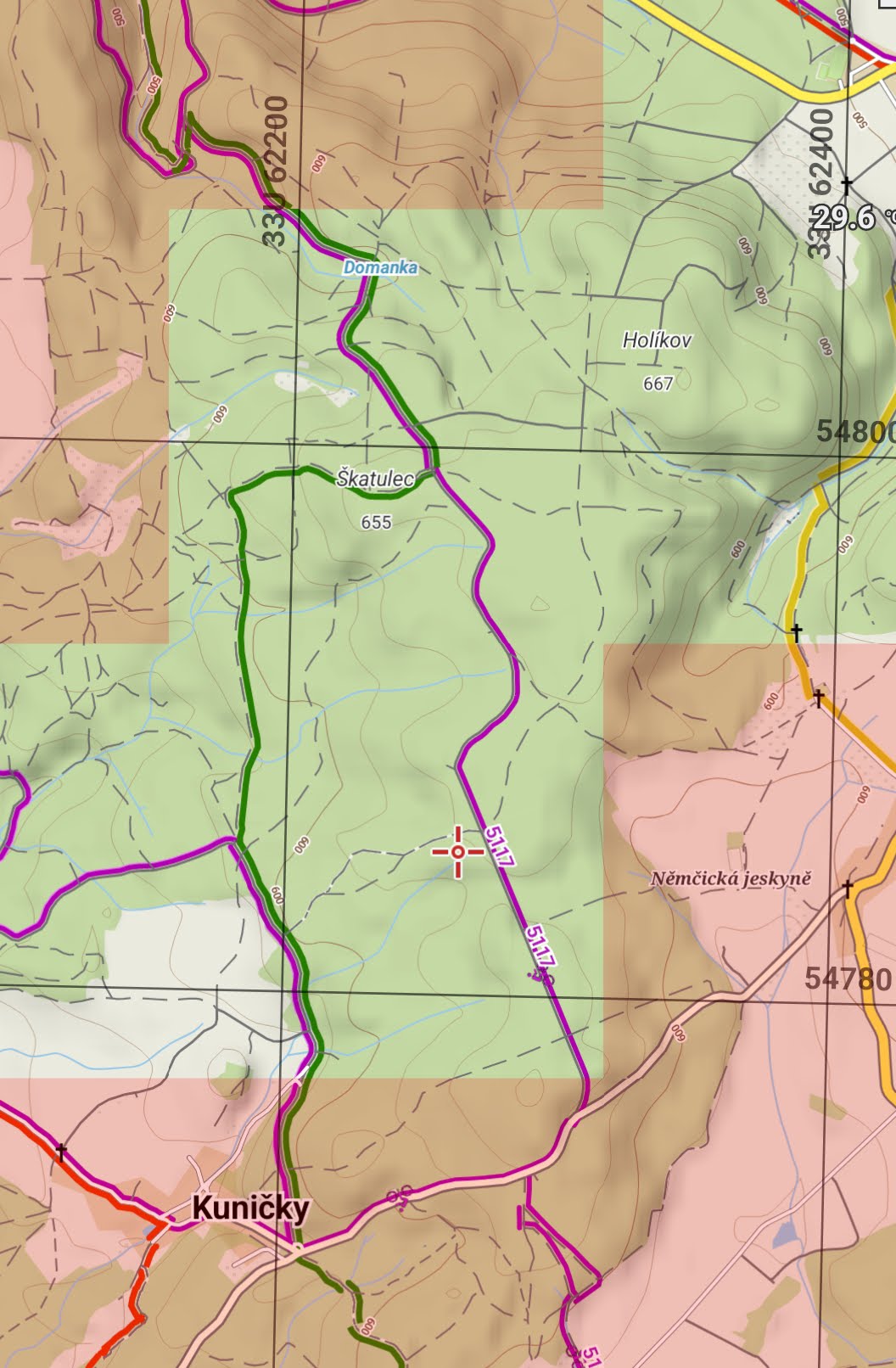
Still can't find where to enable tiles boundary in expert settings, This is how end of section looks for me:
I understand how the eye button works. When I change coordinate unit to UTM, it is somehow close but still not matching and grid changes in each zoom.
Still can't find where to enable tiles boundary in expert settings, This is how end of section looks for me:
just now i´ve noticed (after update to new V4.15.0) that this setting is only available in BETA versions
so please use beta version from menion´s signature till he solved this
just now i´ve noticed (after update to new V4.15.0) that this setting is only available in BETA versions
so please use beta version from menion´s signature till he solved this
Bit clunky, but will better than nothing. LoMaps zoom 15 line up nicely with tile grid.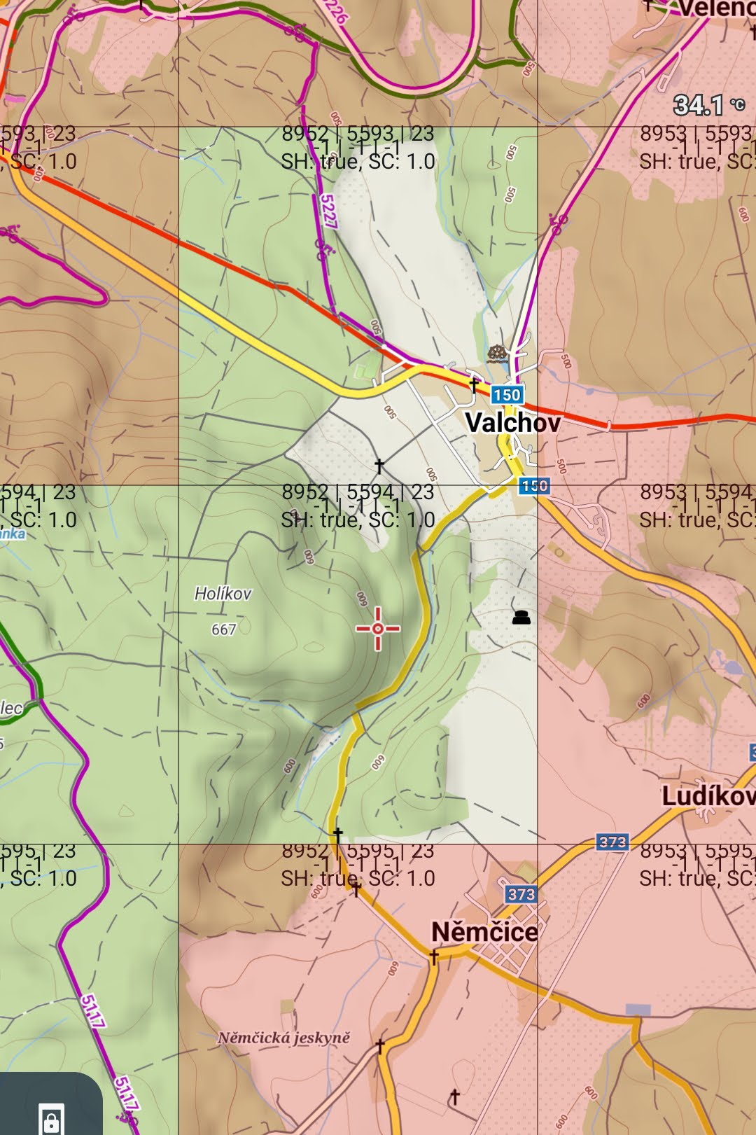
Thanks
Bit clunky, but will better than nothing. LoMaps zoom 15 line up nicely with tile grid.
Thanks
Play store just updated my LM to 4.15.1 yesterday and in GDrive is only alfa for 4.14 which phone refuses to install.
This workaround with map tile boundaries didn't lasted too long for now.
Play store just updated my LM to 4.15.1 yesterday and in GDrive is only alfa for 4.14 which phone refuses to install.
This workaround with map tile boundaries didn't lasted too long for now.
I had written that in my last post.
if you want to keep the beta with display of the map tiles you have to disable the autoupdate in GooglePlay.
For now you have two options:
- you wait for the next beta version
or
- you uninstall Locus, but please backup everything first ! and install again the last available beta version.
I procrastinated whole weekend and instead task I was supposed to do created little script to generate appropriate tile mesh as KML file which I then import to "Active items".
https://github.com/skvedo/tilesBoundariesKml
I procrastinated whole weekend and instead task I was supposed to do created little script to generate appropriate tile mesh as KML file which I then import to "Active items".
https://github.com/skvedo/tilesBoundariesKml
There is already website doing what you guys need. https://vv.fork.pl/
There is already website doing what you guys need. https://vv.fork.pl/
Replies have been locked on this page!