
Change LoMaps contour lines to 10 m
Gathering feedback
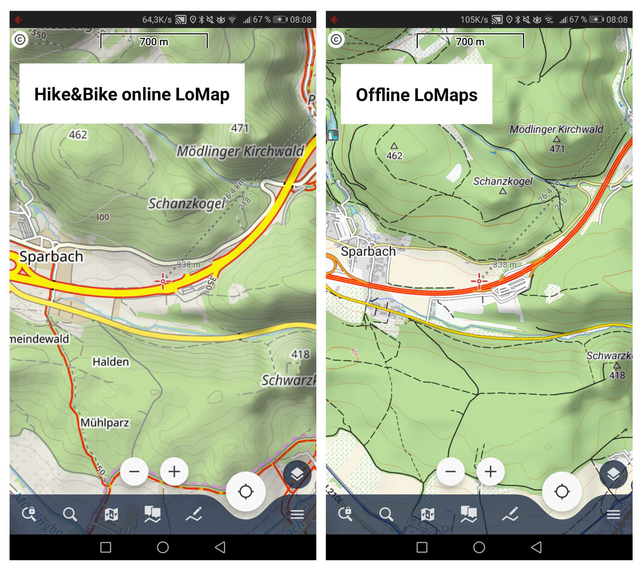
Change equidistance of offline LoMaps contour lines from 20 to 10 meters – similar to the "Hike&Bike" online LoMap. See comparison.
Files:
202109249_08115...
 I like this idea
I support this idea, cause right now LoMaps in alpine terrain doesn't show enoght details for mountain hikers.
And a second but connected request: Please use Sonny's 1" files for the creation of contour lines from https://sonny.4lima.de instead of the now used 3" files. 1" lines are clearly more detailed than 3" lines.
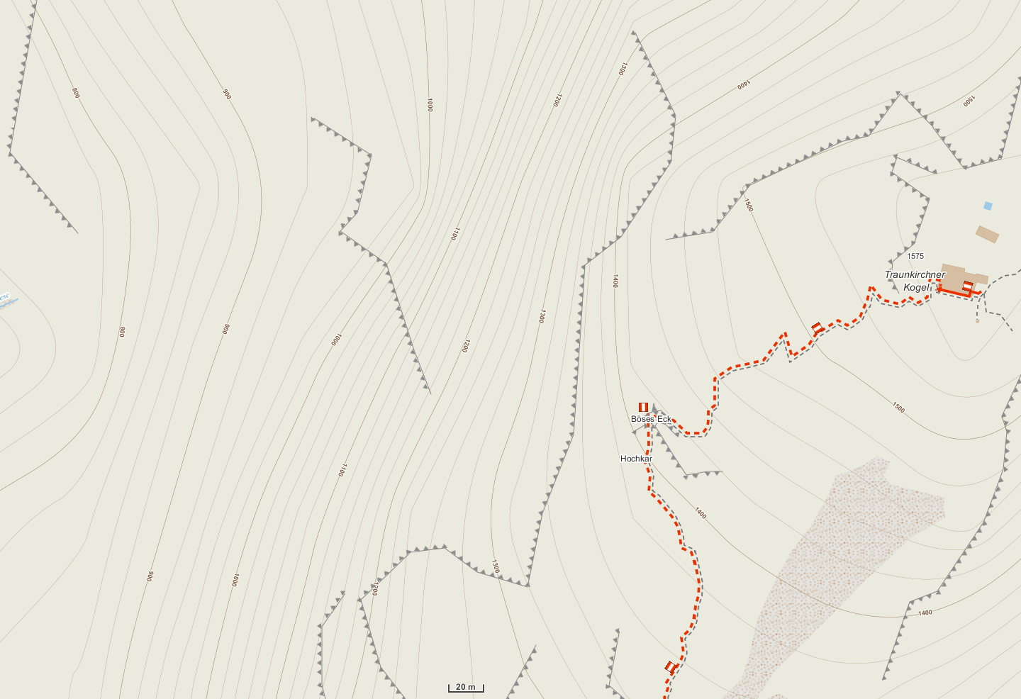
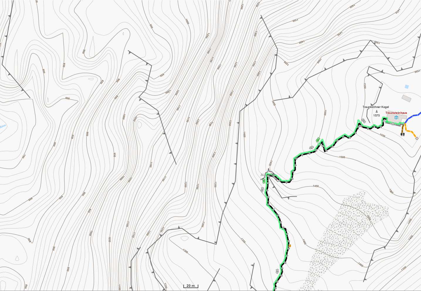
I attached 2 screenshots of the same area to demonstrate the improvements: 1) LoMaps with 20m lines based on 3" hgt-files. 2) OpenAndroMaps with 10m lines based on 1" hgt-files.
I support this idea, cause right now LoMaps in alpine terrain doesn't show enoght details for mountain hikers.


And a second but connected request: Please use Sonny's 1" files for the creation of contour lines from https://sonny.4lima.de instead of the now used 3" files. 1" lines are clearly more detailed than 3" lines.
I attached 2 screenshots of the same area to demonstrate the improvements: 1) LoMaps with 20m lines based on 3" hgt-files. 2) OpenAndroMaps with 10m lines based on 1" hgt-files.
I support this suggestion, because even at not so high montains (smaller hills, soft landscape declines), the contours are better recognizeable on a map with more dense altitude lines.
I support this suggestion, because even at not so high montains (smaller hills, soft landscape declines), the contours are better recognizeable on a map with more dense altitude lines.
Hi all, any update on this?
I absolutely support it too, since all the other maps I use have 10m distance, including paper maps like french IGN top25. Switching from one to another is awkward, and navigating offline with 20m distances is quite misleading and can sometimes lead to dangerous situations or at best small direction errors and time loss on difficult ground (since our brains first think 10m).
Cheers!
Replies have been locked on this page!