
Imported GPX file: no altitude profile, and wrong timescale
Known
Hi all,
I have imported a GPX file in the web planner.
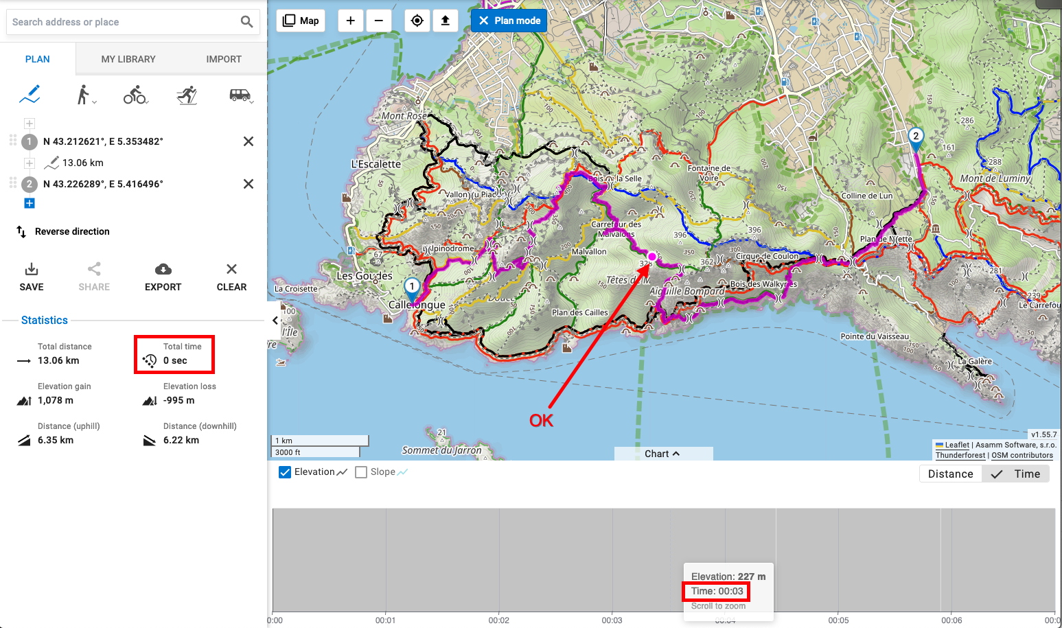
The track is displayed properly on the map, but the altitude profile is blank.
Yet when I move my cursor in the altitude profile:
- The distance and altitude at this point is properly displayed
- The corresponding point on the map moves
On the other hand, if I choose "Time" as the unit on the horizontal axis, the displayed time is completely wrong (00:06 total time for the hike).
Thanks and regards,
Hervé
Files:
LocusMap_GPX_im...
 The same problem
HI Hervé,
could you please send the GPX for a test? Thanks.
HI Hervé,
could you please send the GPX for a test? Thanks.
Hi Michal,
Here you are, but for a different track because the GPX which corresponds to the screen capture is 2.5 MB, hence too large for this form.
But the behaviour is the same.
Hi Michal,
Here you are, but for a different track because the GPX which corresponds to the screen capture is 2.5 MB, hence too large for this form.
But the behaviour is the same.
Hi Hervé,
Thanks for the report, we will look into that. Altitude graph is broken in case of you activity, because it consist more altitude records in the same point of track. We will look into that and try to fix this scenario.
If you are Gold Premium, you can alternatively save the imported track to your library on the web and then you will see the graph correctly, as the data is reprocessed during this action.
Jan
Hi Herve,
The issue you reported should now be resolved. If you still have your large file, could you please try uploading it again and let us know if it works this time?
Thank you very much for your patience and help in testing.
Kind regards,
OJ
Hi Herve,
The issue you reported should now be resolved. If you still have your large file, could you please try uploading it again and let us know if it works this time?
Thank you very much for your patience and help in testing.
Kind regards,
OJ
Replies have been locked on this page!