
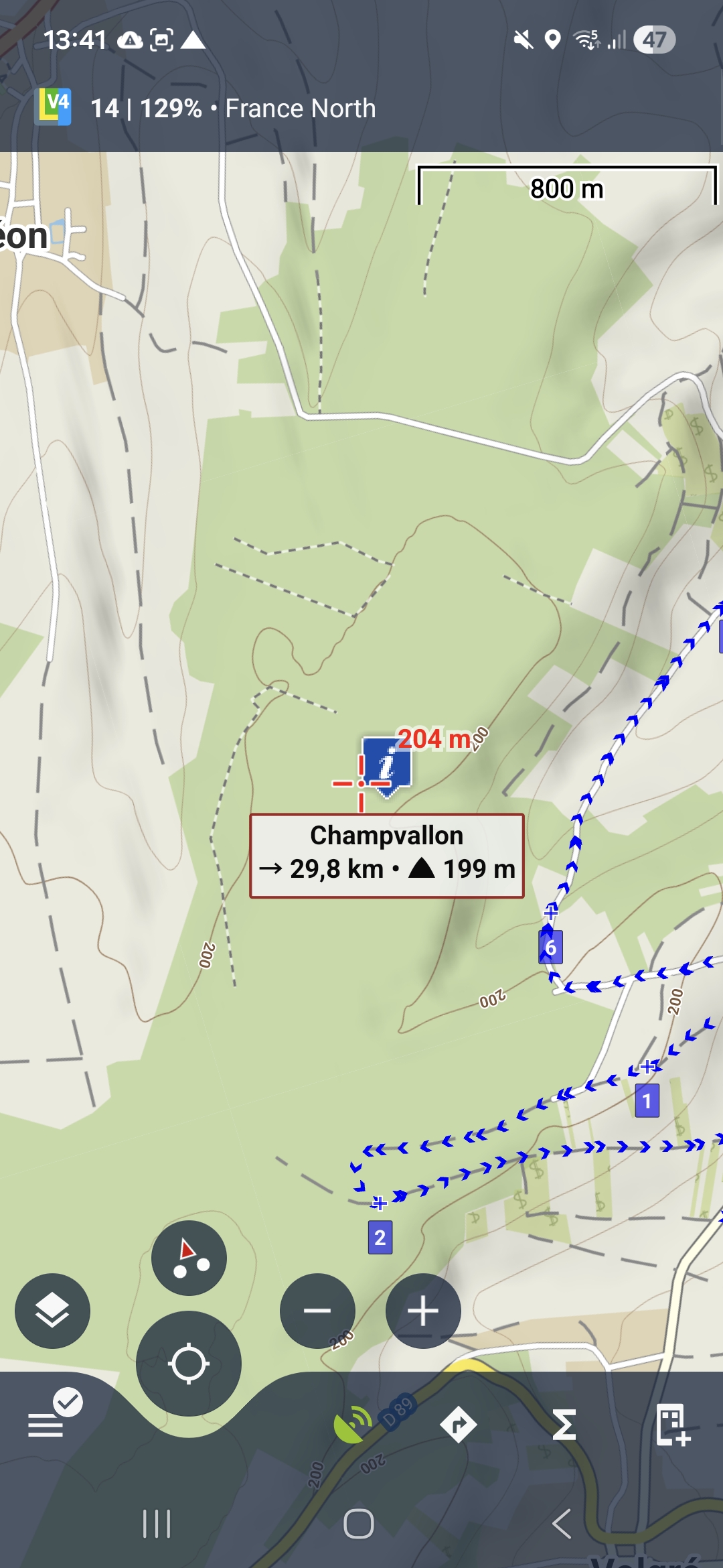
highway=track, grade5 not visible at zoom 14
Answered
Hello Locus team,
It seems strange to see highway=path at zoom 14 and not highway=track grade5. highway=track start to be visible at zoom 15.
I think highway=track grade5 should be visible at same zoom level than any highway=path
France North, Offline and Online LoMap
Screenshoots at location (what3words) boosted.deteriorate.gritty
 The same question
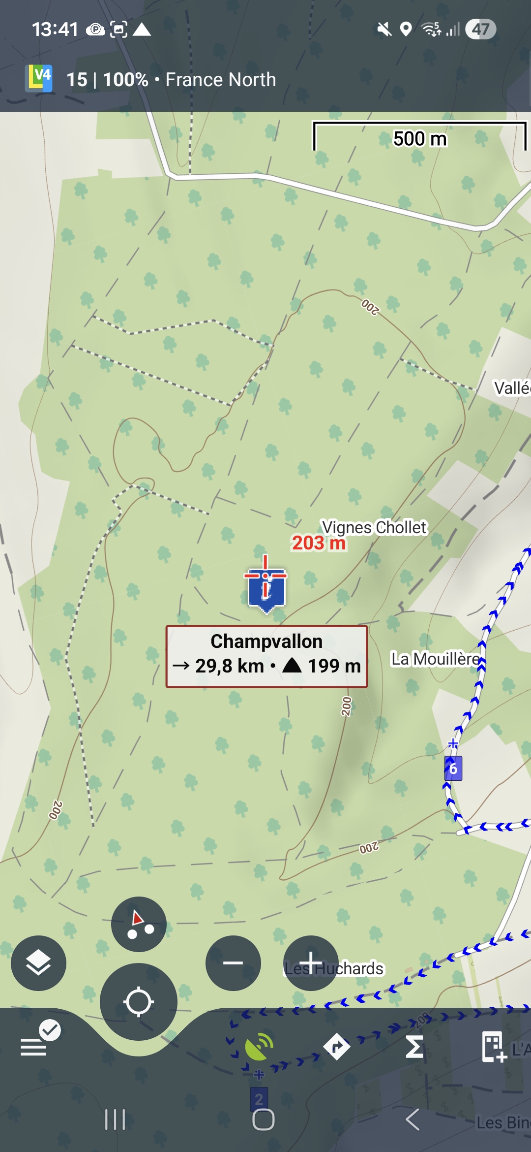
Hi,
thank you for your question. The highway=path becomes visible from zoom level 14 because the mountain areas where it’s important to have context for planning trips and navigation.
Tracks with tracktype=grade5 are often very minor forest tracks, sometimes difficult to pass through (at least here in Central Europe). Because of this, there is a very fine balance between good map readability and overloading the map with too many elements. For this reason we use such approach. I hope the current setup does not cause major difficulties for you.
Thank you
Petr
That's set in the theme. You can create your own theme. I use OAM maps and have the Elevate theme. I made a few changes to that theme and saved it as my own. Now I can switch between the original and my custom theme.
I'm not sure if that works with the Locus theme. I only use LoMap in the background for offline data. Why don't you take a look here?
https://forum.locusmap.eu/index.php?board=40.0
or:
https://www.openandromaps.org/oam-forums/forum/renderthemen
Hello Peter,
Thanks for answer.
I think that all levels of highway=track (even grade 5) can be use for hiking. Grade level make really difference for bicycle/motorbike/cars usability and speed.
I think it's embarrassing when looking map of big area.
But this is only an opinion
Hello Peter,
Thanks for answer.
I think that all levels of highway=track (even grade 5) can be use for hiking. Grade level make really difference for bicycle/motorbike/cars usability and speed.
I think it's embarrassing when looking map of big area.
But this is only an opinion
Hi
I reported this previously as part of https://help.locusmap.eu/topic/38097-webplanner-pathsfeatureszoom-levels
There I thought for highway=track it was the tag surface=unpaved causing them to not be displayed until zoom 15, but now I see it is tracktype=grade5, and perhaps other grades too (I haven't checked)
So I do agree with the OP that, at least for hiking, any track should be shown at the same zoom as highway=path (14) as if a vehicle can use it then you can also walk on it (https://wiki.openstreetmap.org/wiki/Tag:highway%3Dtrack)
Hello,
Where I live in France, there is no montains, but a lot of forests, Over the year I do more hick in forest than in montain. I think a lot of people are like me.
Hello,
Where I live in France, there is no montains, but a lot of forests, Over the year I do more hick in forest than in montain. I think a lot of people are like me.
And remind that often (at least in my area) there is no grade level information (tracktype) on highway=track. It is important to show them at same zoom level that highway=path.
And remind that often (at least in my area) there is no grade level information (tracktype) on highway=track. It is important to show them at same zoom level that highway=path.
Hi,
We performed some additional tests and comparisons, and tracktype=grade5 will be visible starting from zoom level 14 (please note that this applies to offline LoMaps).
Thank you
Petr
Hi,
We performed some additional tests and comparisons, and tracktype=grade5 will be visible starting from zoom level 14 (please note that this applies to offline LoMaps).
Thank you
Petr
Thanks a lot
Thanks a lot
What about Lomaps-online ? Mostly need the tracks visible when plotting the route, and as LoMaps online is the only map available in the WebPlanner currently it's especially important. In the android app we can always use OAM or other map so it wasn't so much of an issue there, at least for me.
(Unless, of course, other maps will also be available in the WebPlanner soon !! ?? )
@Online map – as we’ve probably discussed in another thread, the current online map does not allow deeper customization of the map style. This is mainly because we cannot influence the background data used for rendering.
Hovwever, I can already say that we are planning to create our own online map, where we will have full control over both the data and the appearance. The goal is to achieve an online map style that is as close as possible to the offline LoMaps style.
Hi Petr,
Yes you did explain the difficulty, but you did manage to fix the main issue I reported about highway=footway; also the issue with peak labels missing where there was a cliff running north/south close by. Thanks for those ! So I just assumed this one, highway=track, would be similar.
Glad to hear a new map may be on the way.
Hi,
thank you for the feedback..
Regarding highway=track, if possible, please wait for the upcoming map release
Thanks, Petr
Hi,
thank you for the feedback..
Regarding highway=track, if possible, please wait for the upcoming map release
Thanks, Petr
Replies have been locked on this page!