
This object is in archive!
Add orienteering map made of Finland (MapAnt)
Answered
Basically, "MapAnt" is a gigantic orienteering map covering almost all of Finland. It is licensed under creative commons and serviced by a tile-server. The map would be huge help for everyone in Finland who understand orienteering map features and the fact that this map was not drawn by a human but laser scanning airplane and a heavy-duty cluster of computers. :)
Read more at MapAnt.fi
with best regards, Hannu Hjelm
Files:
MapAnt (1).png
 The same question
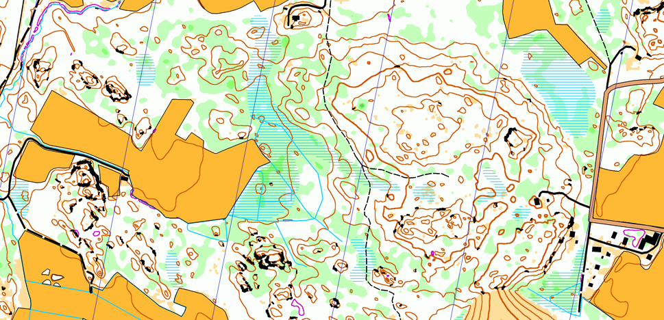
Dear Hannu,
thank you for info about interesting service. However have you already tried Maps > Online > Kapsi.fi > Peruskartta ? Would you please compare it with MapAnt.fi ?
Thank you
Petr
Dear Hannu,
thank you for info about interesting service. However have you already tried Maps > Online > Kapsi.fi > Peruskartta ? Would you please compare it with MapAnt.fi ?
Thank you
Petr
Replies have been locked on this page!