
This object is in archive!
Colour topographic overlay
Answered
Is there a way to use colour topographic maps in Locus? This kind of map is great to overlay!
http://en-gb.topographic-map.com
Thanks,
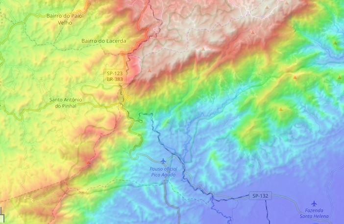
Is there a way to use colour topographic maps in Locus? This kind of map is great to overlay!
http://en-gb.topographic-map.com
Thanks,
 The same question
I mean true color topo scaled map, not the already Colored Elevation option in Map Shading
I mean true color topo scaled map, not the already Colored Elevation option in Map Shading
I'd like to combine standard hill-shading with colored elevation. Well try following:
Regards, Petr
I'd like to combine standard hill-shading with colored elevation. Well try following:
Regards, Petr
Hello Petr,
Thanks for your workaround, that does help! But Locus still misses an automated altitude palette to different zoom levels, as seen in topographic-map.com
There is already a topic idea here, please vote for this feature! https://help.locusmap.eu/topic/automated-altitude-palette
Hello Petr,
Thanks for your workaround, that does help! But Locus still misses an automated altitude palette to different zoom levels, as seen in topographic-map.com
There is already a topic idea here, please vote for this feature! https://help.locusmap.eu/topic/automated-altitude-palette
Replies have been locked on this page!