
This object is in archive!
Problem with map switching
Solved
After last update switching map function has severe problem: in most cases it doesn't work at all (it works only in closer zoom and after long delays). It happens for all offline/local maps - including Compass (bitmap) and Locus (vector).
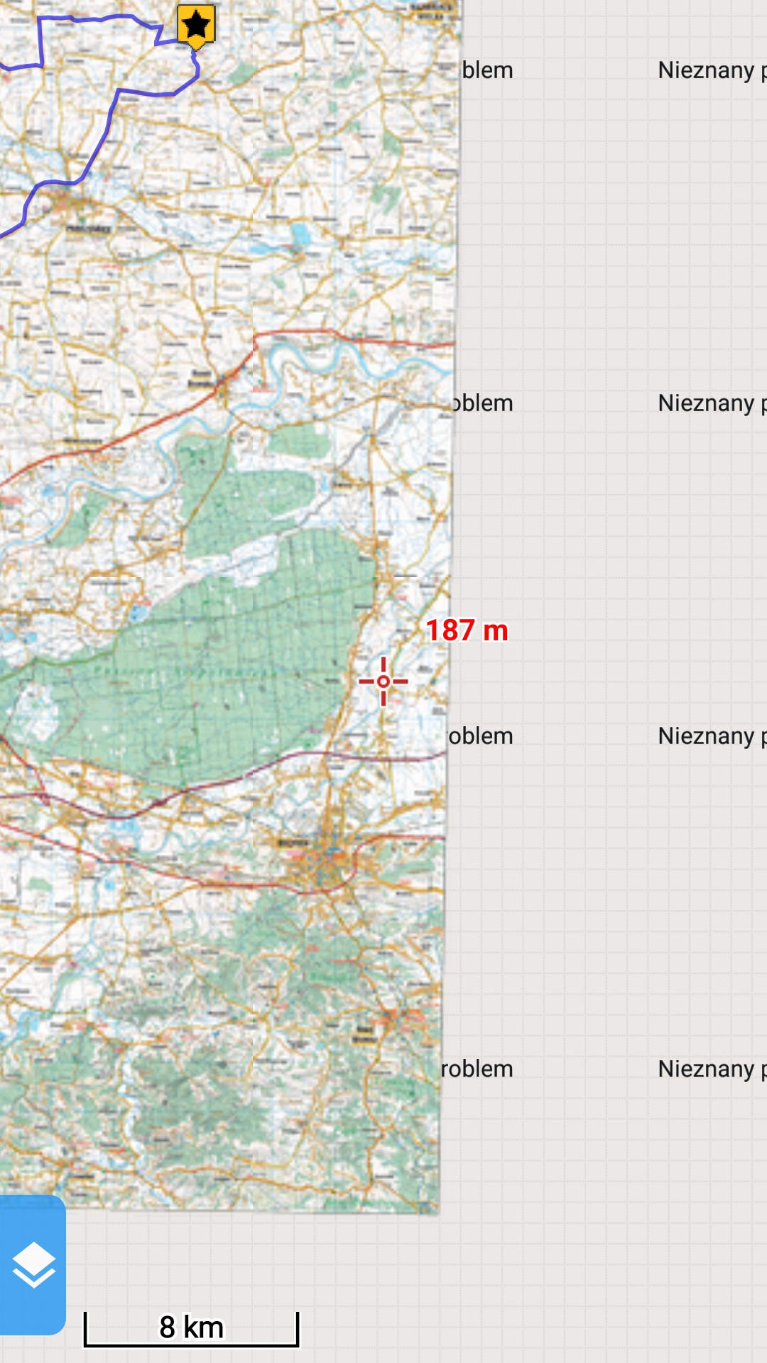
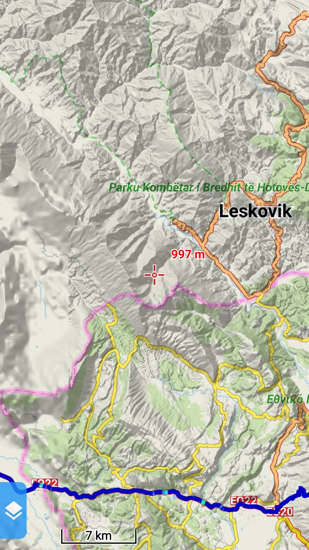
On attached screenshots you may see how it looks on map borders:
From Compass I've bought both parts (east and west), yearlier it switched between those parts without any delay, but now it show only "unknown problem".
On Locus vector map I've bought maps of Greece and Albania but on border maps looks like this - I may only to change map manually.
 The same problem
Good day Jaroslaw,
did you try latest 3.38.7 version? We made quite a lot of changes and improvements in the latest version(s), so switching and auto-loading of maps should be a lot better than in version 3.38.3.
Let me know, thanks.
Jiří M. aka Menion
Good day Jaroslaw,
did you try latest 3.38.7 version? We made quite a lot of changes and improvements in the latest version(s), so switching and auto-loading of maps should be a lot better than in version 3.38.3.
Let me know, thanks.
Jiří M. aka Menion
Good day Jaroslaw,
a few days ago we published new version 3.39. I'm still not 100% satisfied with the auto-loading system but should be definitely better than in 3.38.x version, so please give it a try. Thank you for your patience.
Menion
Good day Jaroslaw,
a few days ago we published new version 3.39. I'm still not 100% satisfied with the auto-loading system but should be definitely better than in 3.38.x version, so please give it a try. Thank you for your patience.
Menion
Yes! It works much better. Thanks!
Sometimes it may be a little confusing when one map ends end there is nothing but white screen but another map appears only after zoom in. But it may have sense (different tiles size of those maps), so I can live with it.
sob., 27 lip 2019, 21:32 użytkownik Locus Map <locus.map@asamm.com> napisał:
Perfect, glad to read it.
As I wrote, consider the current state as "work in progress". We will definitely work on improvements.
Menion
Perfect, glad to read it.
As I wrote, consider the current state as "work in progress". We will definitely work on improvements.
Menion
One snapshot for you: bitmap map with one tile taken from completely random location (in this case - apr. 30km away). This happened to me twice, and this bad tile disapears (is replaced by proper one) only when I scroll or zoom.
One snapshot for you: bitmap map with one tile taken from completely random location (in this case - apr. 30km away). This happened to me twice, and this bad tile disapears (is replaced by proper one) only when I scroll or zoom.
I may for now only hope, it won't happen too often. What is on your screenshot is really weird, but I'll have to catch this issue on own device.
Thanks for understanding.
I may for now only hope, it won't happen too often. What is on your screenshot is really weird, but I'll have to catch this issue on own device.
Thanks for understanding.
It happens to me quite often (again yesterday), maybe because of my large collection of "Compass" maps (bitmap: 11 maps bought in Locus + 37 maps bought in external shop, in .tar format). And I have to correct: bad tile disappears _only_ after zoom.
It happens to me quite often (again yesterday), maybe because of my large collection of "Compass" maps (bitmap: 11 maps bought in Locus + 37 maps bought in external shop, in .tar format). And I have to correct: bad tile disappears _only_ after zoom.
And one more thing - I saw it once, in previous, unstable version, so I know that it is possible: when I set for local maps to switch between any type, Locus displayed bitmap maps for areas covered by them, and vector map in all other areas. Now this behaviour dissapeared - no matter what I set in settings, only switching between the same type works - like on attached screenshot.
Of course It is much better to have current, almost stable version, but maybe in future it might be possible to switch seamlessly between bitmap and vector maps. It would be great advantage of using Locus!
Hmm combination of 11 SQLite based Locus maps and 37 TAR based maps may be really deadly combination. This TAR format may be the reason why you see what you see.
Does this problem happen always on the same place with the same map or is it quite random?
Any combination of vector maps & raster maps, you are right, this was enabled in one of testing version. It was more by and accident then an intent. Currently, mainly because of performance reasons, this option is disabled, but agree it may be useful and I definitely do not say "no" to this option in the future.
Hello Jaroslaw,
sorry for the delay. I've finally found a time to download and test your map.
To be true, I do not know where to start. You have 40 maps that are completely randomly distributed ... here is coverage visible in my test version:
This is crazy :). This really worked before? I'm surprised.
You wrote that maps are from two different sources. From my point of view, best try should be to
With these settings, you should see in Locus Map only two (multi) maps named by two mentioned folders. With disabled auto-loading, the app should work only with maps in one selected folder. Maps from Locus Store should have minimal (if any) overlap.
Your setup is really too complicated. If the method I wrote about won't work, I may for now really only suggest reducing map that overlap (split) or downgrade on older Locus Map version.
This problem will be most probably solved one day, but I currently do not have in head some easy-to-implement algorithm that should correctly handle this.
If there will be anything you may need to explain etc, feel free to write to me. Thanks for understanding.
Menion
I reckon my problem is the same. I upgraded to 3.39.3 a few days ago. Since then, my maps will not load properly - only in patches and at arbitrary zoom levels. I am using offline downloaded raster maps. I have played around with "offline maps autoload" and this helps a little (or it's just a coincidence). But autoloading still doesn't work (even though I have set "autoload maps of identical type) - I need to move between maps by selecting each map as I move around.
I reckon my problem is the same. I upgraded to 3.39.3 a few days ago. Since then, my maps will not load properly - only in patches and at arbitrary zoom levels. I am using offline downloaded raster maps. I have played around with "offline maps autoload" and this helps a little (or it's just a coincidence). But autoloading still doesn't work (even though I have set "autoload maps of identical type) - I need to move between maps by selecting each map as I move around.
Replies have been locked on this page!