
Only for sharing - To see better the type of road behind the track line on map
My target. During the preparation of futur Gravel tracks at home, I would like to understantd as much as possible the difficulties of the path.
My problem. The line of track hides "small roads" type like trails, tiertiary, singles. I can not see the type of road and this is anoying.
My way (this way is not new. https://help.locusmap.eu/topic/38042-change-guiding-line-apperiance).
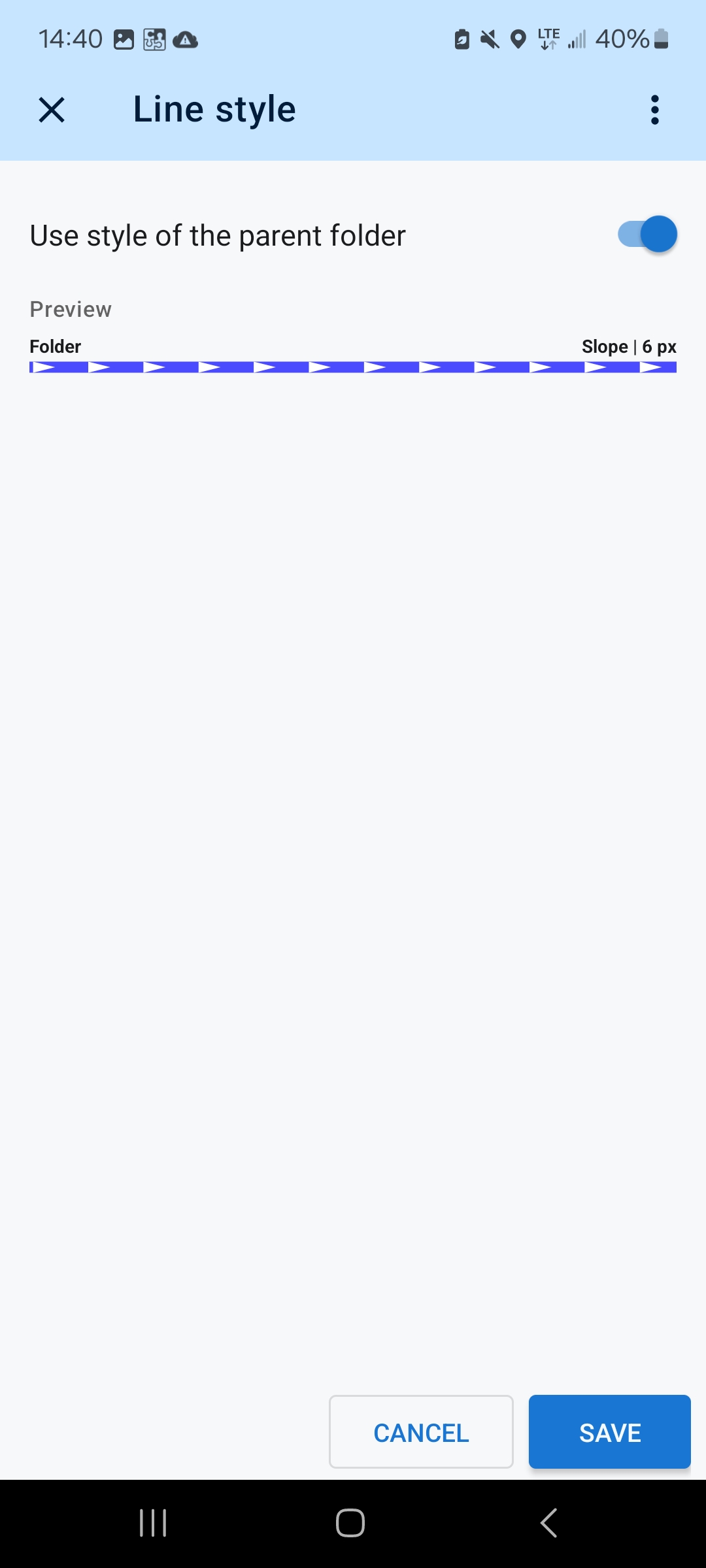
Settings
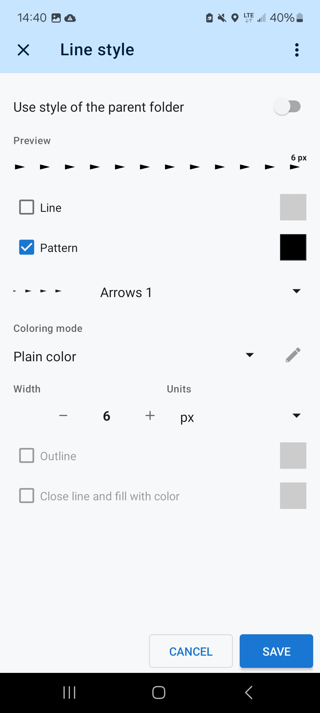
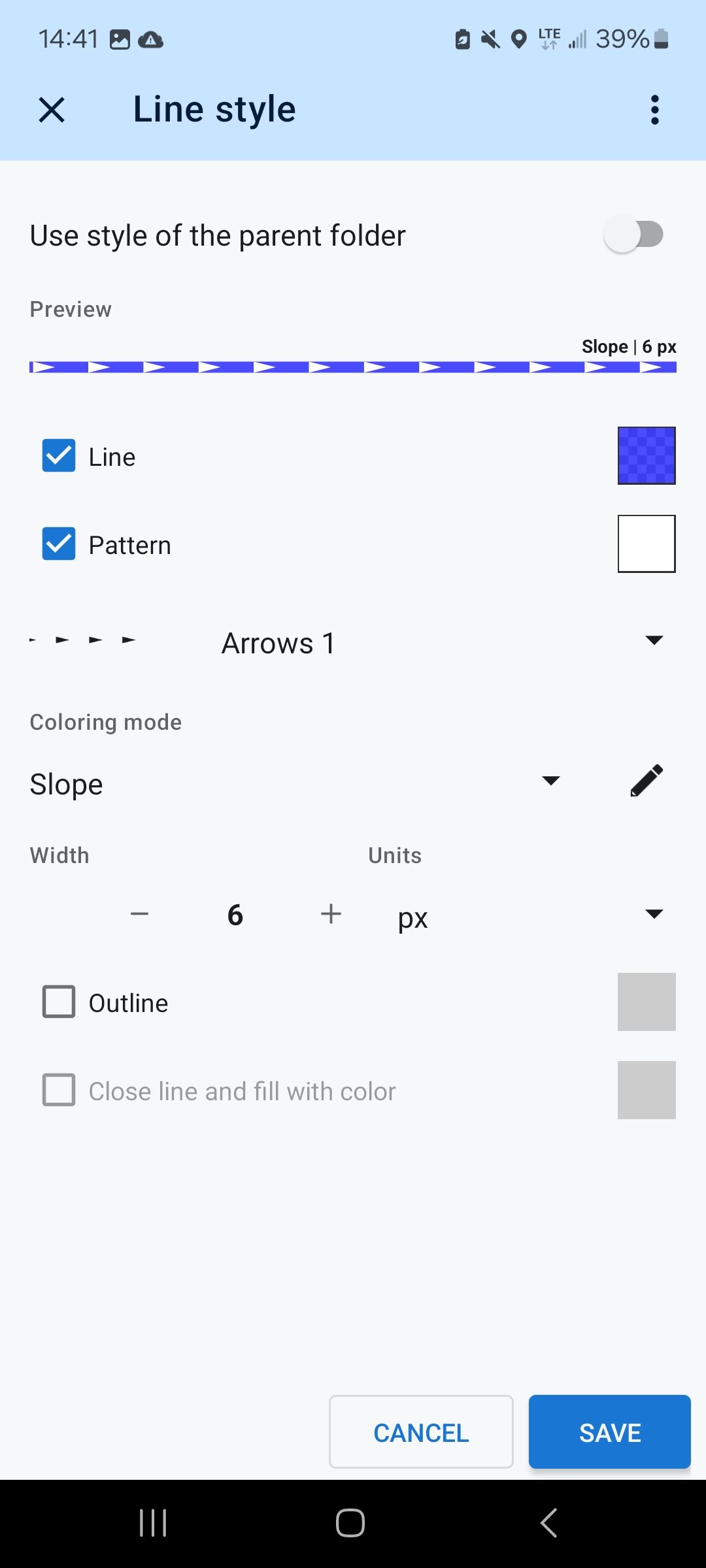
I change the line style map of the track, to keep only the arrows (pattern), without line.
In order to be practical I set things like that:
- Line style map of the folder are set in my standard style. For me it is coloring mode = slope.
- Tracks are created using style of parent folder.
- On tracks, I set a specific line style: Line off, Black pattern color, Arrows 1, Coloring mode = Plain color.
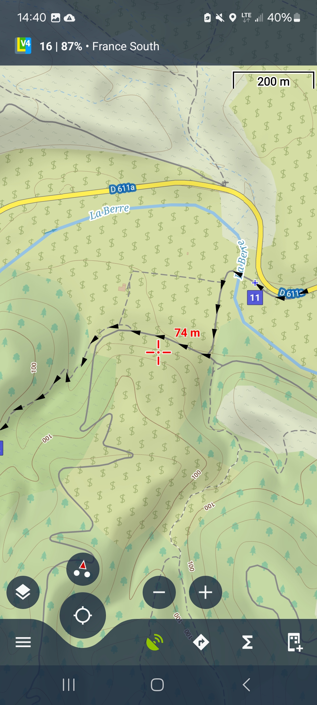
Check 1, on LoMaps
I edit info/Style on map: uncheck "Use style of the parent folder" and save (twice).
I can see the track (arrows) and the type of road between arrows.
Check 2, on Map overlay
I activate Map overlay and select "Asaam - Satellite Hybrid".
I can see more or less the width of track, between arrows.
A the end, I edit info/Style on map: check "Use style of the parent folder".
 The same question
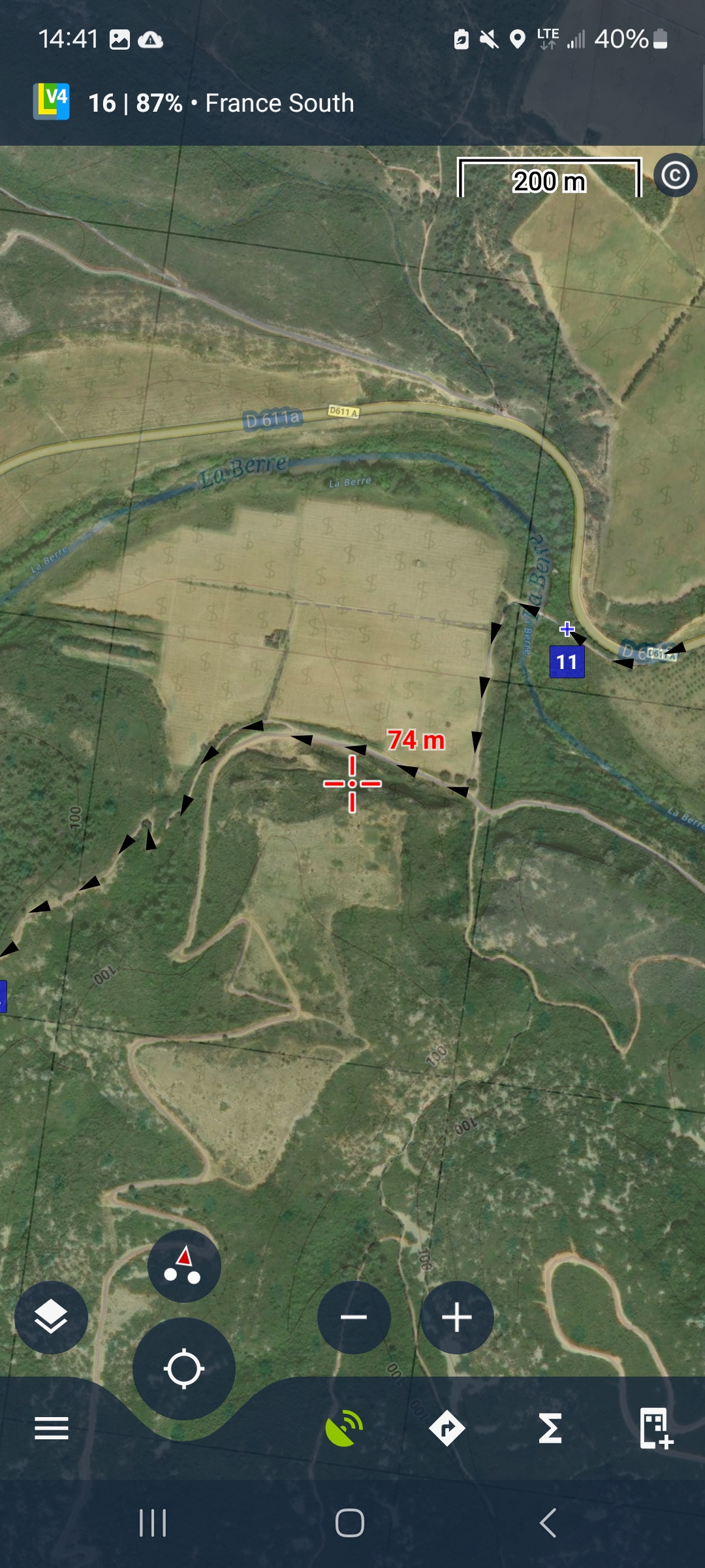
What is the suggestion though? I often have the same issue. I sometimes temporarily hide the track or make the width 2px so I can see the surface better. The online BRouter web planner allows the user to press & the hold "M" key to "mute" (hide) the track while the key is pressed. Fantastic feature. Maybe a side panel function button could be designed that only while tapped+held all items are hidden.
What is the suggestion though? I often have the same issue. I sometimes temporarily hide the track or make the width 2px so I can see the surface better. The online BRouter web planner allows the user to press & the hold "M" key to "mute" (hide) the track while the key is pressed. Fantastic feature. Maybe a side panel function button could be designed that only while tapped+held all items are hidden.
I am missing an option with a larger distance between the arrows. There are fewer arrows in the standard navigation line.
An additional arrow where only every 2nd or 3rd arrow is present.
I am missing an option with a larger distance between the arrows. There are fewer arrows in the standard navigation line.
An additional arrow where only every 2nd or 3rd arrow is present.
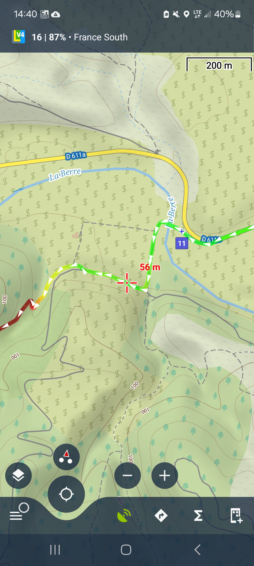
Locus Map's line style editor offers many options. Everyone can choose. This one combines good visibility of the underlaying map and slope gradient coloring of the route direction arrows:
Locus Map's line style editor offers many options. Everyone can choose. This one combines good visibility of the underlaying map and slope gradient coloring of the route direction arrows:
I like your colored arrows. But I have 2 problems with them.
1. the arrows are too many. here would be an option already, only half of the symbols. That way everyone could use them on all patterns.
2. if I deactivate line, then I can no longer make a border.
If I activate it and make it transparent, I can no longer make the arrows colored.
If I use the whole thing as a line style for the navigation then there are further problems. With the simple style there is a function so that the line is bold in the near area. In the area further in the future it is narrower and slightly transparent. This is very important when the tour overlaps. But I don't have these functions in the user-defined style.
If I use the whole thing as a line style for the navigation then there are further problems. With the simple style there is a function so that the line is bold in the near area. In the area further in the future it is narrower and slightly transparent. This is very important when the tour overlaps. But I don't have these functions in the user-defined style.
Many thanks Michal,
Coloring arrows with slope is fantastic. It is fine for me.
So many possibilities in Locus map.
Many thanks Michal,
Coloring arrows with slope is fantastic. It is fine for me.
So many possibilities in Locus map.
Michal,
Is it posible to add your exemple of settings in the Knowledge base ?
Michal,
Is it posible to add your exemple of settings in the Knowledge base ?
Replies have been locked on this page!