would be nice to have a feature to show kilometer marks on the track dislplayed on the Locus screen. Similar to what you can swith on/off in GPSies. This could be a customizable feature (how frequent the marks are displayed, distance between marks, km/miles, etc.) that would also depend on zoom level.
This feature might come in handy if your route/track for several days is just one long line and you would like to understand where you probably be in some hours knowing your average speed (i.e., decide on when/where before sunset you are going to stop for the day and make a camp). For bicyclists this might be especially handy

 I like this idea
This!
Now that Brouter integration in Locus seems to be rock stable, would'nt this be the ultimate summer gift from team Locus to the community?
Let's vote!
Watch attached dropbox video link (10 MB)
This!
Now that Brouter integration in Locus seems to be rock stable, would'nt this be the ultimate summer gift from team Locus to the community?
Let's vote!
Watch attached dropbox video link (10 MB)
+1, für Idee
+1, für Idee
+1
And also would be useful to have "Time markers", and to see these markers not only for the recorded tracks but for the current as well
+1
And also would be useful to have "Time markers", and to see these markers not only for the recorded tracks but for the current as well
please add this feature. it would be a great addition to the app
please add this feature. it would be a great addition to the app
Ah yes, both time markers and distance markers would be most valuable.
Ah yes, both time markers and distance markers would be most valuable.
46 votes and no implementation yet?
This feature is needed urgently. Not only for estimating the distance but for pointing the right sequence where the track crosses itself or in loops...
@menion - any progress?
46 votes and no implementation yet?
This feature is needed urgently. Not only for estimating the distance but for pointing the right sequence where the track crosses itself or in loops...
@menion - any progress?
Any news on this one?
Any news on this one?
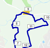
Urm, dont we have this already , in intervals tab of track, display on map, im seeing little markers every km and different coloured sections.....
Urm, dont we have this already , in intervals tab of track, display on map, im seeing little markers every km and different coloured sections.....
Didn't know this option before. Thanks for pointing that out.
The "problem" here is, if you leave the map view and go back into it, the markers are gone. Or am i missing something?
Didn't know this option before. Thanks for pointing that out.
The "problem" here is, if you leave the map view and go back into it, the markers are gone. Or am i missing something?
I am also looking for km/distance markers.
The intervals workaround doesn't seem to apply/work with my version (3.47.2). It says "no intervals here" [...] "this route doesn't contain time values". Well, I don't want to display time but distance markers. Am I in the wrong intervals tab? (clicked the track, then the arrow, then "track detail")
Another vote for this! It would be really helpful to quickly estimate distances on tracks with a lot of bends without having to tap around on some points on the track to see the details!
Another vote for this! It would be really helpful to quickly estimate distances on tracks with a lot of bends without having to tap around on some points on the track to see the details!
By the Planner add as discrete km marker ref target Shape points and make so available for Navigate Point Priority autorecalculation. As only the Point Priority mode is for sure the most performant and more reliable autorecalculation mode variant in Locus.
But Locus incomprehensibly removes these valuable Shape Points once out of the Planner, contrary to the usefull navigate use as by Garmin and Kurviger.
Garmin & Kurviger Free Pass, so not MUST Pass, ref Shape Points @ navigate are not announced, and Kurviger app discretely shows the Shape points in the map display. (Do not know if Garmins do show). The Shape points are also exported in the external file, so this valuable design info is not lost and is perfectly reconstructed at a re import in the planner.
https://help.locusmap.eu/topic/shape-point-transfer-by-gpx#comment-87469
Any news here? Distance marker are urgently needed.
Any news here? Distance marker are urgently needed.
The gpx trackdesign (no turn instructions into associated navigation waypoints) contains so only the generated km tickmarks in waypoints.
(For a most nice compact and nice waypoint list attaching the turninstructions into the individual (gpx) trackpoints would be the prefered method)
This so most compact gpx waypoint list than only contains: "The distance wpt tickmarks". (generated by gpxvisualizer)
By the non supported <sym>tickmark, these tickmark points are than represented by the Locus default Icon.
Default Locus Icon: The Garmin <sym>"waypoint" as a very discrete miniscule black dot Icon.
Hoovering over these black dots displays than shows the wpt <name>. (xx km)
The km distance tickmark waypoints (also with recorded tracks) used diferently ;-)
https://youtu.be/fOBjFWrMByQ
Demo video demo with a very simple bike route, yes you can ride this without any navigation instructions ;-)
Unfortunately, I had not recorded the ride. So for this simple demo, I used a fietsnet web track.
Fietsnet web tracks usually deviate a bit (sometimes quite a lot) from the osm street positions, so they are suitable for the test.
In the track, waypoints (gps visualizer web) km <sym>tickmarks <type>shaping have been added and thus optimized for Kurviger import
The Kurviger (online) router generates unfortunately only motorbike tracks, so I used BRouter (offline) with the bike trekking profile here.
GH online would be more optimal, as it not only generates less but also almost more optimal navigation instructions as well as the interesting*U-turns. However, most routers do not generate U-turn commands, you will then continue to drive into the wrong direction if you only base yourself on voice instructions until you soon than get the out of track sound alert.
The many Shaping km tickmarks are thus "snapped" to the nearest street (matching the profile) as routing references.
Result. Demo with Kurviger_ BRouter !
Couldn't find a possibility for such a demo with Locus, so here with the other app sorry ;-)
Note the fast (< 1 sec) route calculation even when using multiple Shaping Points. (Even up to 200 wpt this runs smoothly)
The route design so follows (map matching) the osm street pattern inclusive the turn instruction generation.
Anyway always check carefully whether the desired roads have been "snapped" to the expected road street or path !
You will quickly notice some deviations as the import track remains visible as an overlay. Nice simple and good.
Adjust the routing result if necessary by moving a shaping point or by an extra shaping point.
Note the navigation instructions.
Brouter generates a lot of (too many) Straight commands, even other turn instructions are sometimes not optimal and so misleading :-(
* (180° Non directional U-turn)
U-turns are interesting track glitch indicators which arise when a shaping point is positioned on a wrong track at road junctions.
U-turns are then preceded by an unnecessary first turn instruction followed by a third, again corrective, turn instruction.
U-turns are almost always undesirable. Removing the triggering Shaping Point eliminates both the U-turn and the unnecessary turn instructions.
Discover track glitches through the U-turns detection in the instrcution list, Well to say at least if the router (GH) supports and generates these.
This way you can quickly "eliminate" the corresponding Shaping Points with the U-turns and obtain a track without (small) annoying trackglitches.
Translated with http://www.DeepL.com/Translator (free version)
Hi guys,
I'm finally working on this task and I have an important question, please think about it for a while.
Btw. warning: feature will be available only in Locus Map 4, Silver+ subs.
Poll created in the initial post of this topic, so please vote there!
Give me please your opinion. This is an important question because it affects if you want to just quickly show these marks for a while only (option 1) or have them permanently visible for certain tracks (option 2). Thanks.
Sounds great!
I already thought about it and for me: option 2.
I need it only in some tracks.
Sounds great!
I already thought about it and for me: option 2.
I need it only in some tracks.
Personally, I would add it under: "Contents of the screen with the map" to the "Different" section. See SCR. It could also be in the Presets menu.
Personally, I would add it under: "Contents of the screen with the map" to the "Different" section. See SCR. It could also be in the Presets menu.
I need to find the poll. I'm undecided as of now. As Andrew Heard wrote, it is important that they aren't just waypoints. Just visually, no interactive elements please. There's enough going on on map...
I'm thinking it should be per-track, but also in an easy togglable way. You could at that toggle to the new track detail window. Markers on all tracks, if there are many tracks visible on map, are counterproductive.
No worry, this is how it looks now, no active elements, only visual text labels. Intervals are defined in the code based on the zoom level and selected distance units.
The poll is in the initial post, so please vote there.
No worry, this is how it looks now, no active elements, only visual text labels. Intervals are defined in the code based on the zoom level and selected distance units.
The poll is in the initial post, so please vote there.
Here too: a circle ON the track with the km mark in it.
When will the feature be available?
Here too: a circle ON the track with the km mark in it.
When will the feature be available?
@Andrew.
Quote: "I don't think distance marks should be considered as waypoints? Maybe I miss your point"
Perhaps it was not entirely clear indeed.
Tickmark markers will of course be an entirely internal Locus function.
I can't and couldn't demonstrate km tickmarks of course if that function wasn't there.
I also do not ask to generate tickmark waypoints and export them into the gpx.
For demos I could only work with 'real' waypoints though. (compex workaround)
Then the sequel:
Next belong to: (=Very hard to realise succesfully !)
Track map matching and thereby attach high quality nav instrcutions by a router.
I figured out that you can also use those distance tickmarks functionally.
So you can do track map matching and so still generate a reliable navtrack.
Remains only a small chance that km tickmarks are at critical road crossings.
Previously I had tested this using the Locus planner with Via km tickmarks and a recalculate all.
However, the Locus map recalculate all result is disapointing unusably slow and freezes sometimes..
I then quickly gave up on the tickmark idea attempts as beeiiing an impractical idea.
Only later I discovered by the other app that it really can be done very nice and fast.
But it still went wrong because there were sometimes annoying trackglitches. (Not easy!)
But by the demanded U-turn support, used as trackglitch detector (180° trackfold) is now optimizable.
Removing those shaping points that generate U-turns produce tracks without annoying glitches.
Possibly will be developed further as a useful design alerting tool. The sooner dedected the better.
Works for designs where many tend to place planner shaping points near road intersections and thus click on the wrong street.
Then complaints like the navigator says to go right but the road goes left. Clicking close to road junctions is only possible if you do not generate any U-turns.
The route planner should then sound the alarm if you do generate a U-turn. You can then decide for yourself whether this U-turn should be planned or not.
Translated with http://www.DeepL.com/Translator (free version)
You could also specify it in the track. And then via the Map Content Panel, show and hide.
So we have both votes in one solution.
Those who want all tracks globally always choose it in the track. And you can quickly show and hide it using the map content panel.
Those who only want certain tracks only select these and can also show and hide them via the map content panel.
Will be available distance marks on the current track? What do you think about time marks on a track?
Will be available distance marks on the current track? What do you think about time marks on a track?
Hi guys,
if you find a moment, give a try to the new Beta version of LM4: http://bit.ly/lmVersionsTest.
In the app settings > Points & Tracks or in the "Quick settings" is an option to toggle distance markers on/off.
For now, it is made as a global setting for all visible tracks. The result of the poll was clearly for one choice and this easier solution allows us to use this feature for a while to see ...
---
Options to consider later
I've noticed important note- "feature will be available only in Locus Map 4". Does it mean that that no future plans to add in to the Locus Map Pro? And what with implementing other new ideas for Locus Map Pro? (Actually i've known about Locus Map 4 only in this topic)
I've noticed important note- "feature will be available only in Locus Map 4". Does it mean that that no future plans to add in to the Locus Map Pro? And what with implementing other new ideas for Locus Map Pro? (Actually i've known about Locus Map 4 only in this topic)
For me the markers are taking too mich space. Small circles with the km mark and without the unit are absolutely enough.
Turning the marks on/off in general settings is ok, setting it for the single track would be better. I mostly need it in route planner and there would a switch be a great thing.
But: thanks for your work. This was the mostly missed feature for me im LM.
Please see my screenshot. A mark at ever km of a track could be a good thing, but often it's too much.
Setting this up in global settings at the moment when needed isn't a solution. So I repeat my whish to get settings for distance marks in track settings. Doesn't matter if in route planner or in normal view.
And I repeat again: please smaller with a circle on track with the pure km count without the unit.
Same style like in brouter web.
When using the beta: will I get further updates via PlayStore?
When using the beta: will I get further updates via PlayStore?
Hi guys,
new version 4.4 was just published to Google Play so feel free to test and report your "feelings".
Known problem: incorrect values reported for non-metric units.
@Jan Richter: sorry for missing answer. Yes, you should get update from Google Play even when using Beta versions.
Hi guys,
new version 4.4 was just published to Google Play so feel free to test and report your "feelings".
Known problem: incorrect values reported for non-metric units.
@Jan Richter: sorry for missing answer. Yes, you should get update from Google Play even when using Beta versions.
You've done a very good job. I like it.
You've done a very good job. I like it.
Hi,
Great feature - I really like it.
my Feeling in accordance with the poll: Could this be a switch in the track properties instead of a global setting? So this could be switched on/off on a per track/folder basis. So the feature would be more flexible and less confusing if there are multiple tracks displayed at the same time.
Greetings, Ulrich.
@Menion,
I really like this feature - although agree that I'd prefer to see it on a per track/folder basis.
I have my setting in miles. When zoomed out of a 50 mile route, the markers are every 2 miles which is very logical. However, if I zoom in the first marker is "1000" (I think that should be 1) and subsequent markers are 1.1, 1.7, 2.8, 5.1, 10.2, 20.5, 21, 21.6, 22.2, 22.7, 23.3 etc etc. So seems like (i) a number of markers are missing at the start of the route and (ii) I would expect these to be increasing either every mile (e.g. 21, 22) or half mile (e.g. 21, 21.5, 22). As far as I can tell the actual values are correct (although haven't checked fully).
Sorry, not sure if this is what you mean when you say incorrect values reported for non-metric units?
https://help.locusmap.eu/topic/kilometer-marks-on-trackroute#comment-70578
This text "pointing the right sequence" triggers so the following thought.
Tickmark km points are perfectly located on the track, just like Via Points or unannounced Shaping Points.
Nice and clear (km select) next "targets" if a "road diversion" unexpectedly appears in front of you.
Skip those km tickmarks of which you know or suspect that they are still located in the road diversion.
After leaving the original track continue than by using the well functioning (auto)recalculate by point priority.
To keep the best informative overview, Locus of course keeps than showing the original track as a simple "overlay".
https://help.locusmap.eu/topic/navigation-onscreen-trackcopy-of-original-planned-route#comment-102981
Hi,
An other Idea/suggestion for this feature: In some cases it is useful to have the km-Marks as a countdown to the destination instead of a count-up from the start.
When the feature is on a per track basis, this could also be a toggle switch (count up/count down)
lG uk
Hi,
An other Idea/suggestion for this feature: In some cases it is useful to have the km-Marks as a countdown to the destination instead of a count-up from the start.
When the feature is on a per track basis, this could also be a toggle switch (count up/count down)
lG uk
Replies have been locked on this page!